

Lp E12 Dummy Battery Kit for Eos M50 II
KSh 3,000.00
70mai dash cam 4K A800SE
KSh 19,000.00
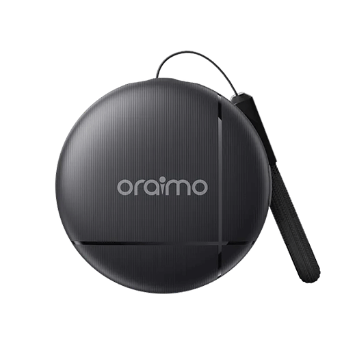
oraimo OTag IP65 Waterproof Android Item Locator
KSh 2,500.00
- ltem Locator
- Material: ABS
- Product Size:31.8mm*31.8mm*8.6mm
- Battery: 220mAh(CR2032/3.0V)
- Usage Tlme: 8-12 Months
- Native OS Secure Data
- IP65 Waterproof
- Built-in Buzzer Tracker
- Accurate Location Finder
Kindly Note: Prices and Stock Status are Subject to Change without Prior Notice
Description
oraimo OTag IP65 Waterproof Android Item Locator in Kenya
oraimo OTag IP65 Waterproof Android Item Locator price in Kenya is KShs.2500
Native OS, Secure Data
Directly Compatible with Android
Directly compatible with Android, comprehensive protection for your data security. No more worries about privacy breaches..
Locate by Sound, Accurate Positioning
Built-In Buzzer Tracker
Built-in buzzer for a smarter and more convenient finding experience.
Waterproof Design, Safe to Use
IP65 Waterproof
IP65 waterproof rating ensures worry-free use in rainy conditions or against splashes.
Extended Usage Time
Ultra-Long Battery Life
Nearly a year of ultra-long battery life, keeping you company longer.
What’s in the Box?
oraimo OTag Item Locator ×3
Portable Strap ×3
Welcome Guide ×1
Shipping and Delivery
Related products
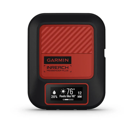
Garmin inReach Messenger Plus
- Exchange texts, photos and voice messages without cell service
- Pair with the Garmin Messenger™ smartphone app for group messaging and more
- Trigger an interactive SOS message to Garmin Response℠, our 24/7-staffed international coordination center
- Use the Garmin Explore™ smartphone app to plan your trip, track your activity and more
- Easily navigate back to where you started with the TracBack® routing feature
- Use the Garmin Messenger™ app to share your GPS location via live tracking
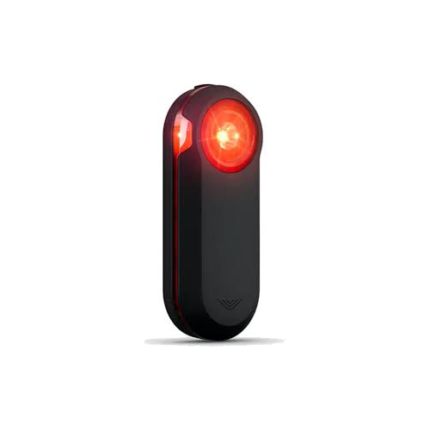
Garmin Varia RTL515 Rearview Radar with Tail Light
- Rearview radar with tail light provides awareness of vehicles approaching from behind up to 153 yards away
- Daylight visibility up to 1 mile alerts motorists to bike's presence as soon as possible
- Peloton mode provides a low-intensity light flash that's ideal for cycling in groups
- Compact vertical design mounts easily to most road-use bicycles
- Pairs seamlessly with Garmin Edge bike computer or compatible smartphone as well as select Garmin wearables or the Garmin radar display unit
- When radar device is used with compatible smartphone, the Varia app provides graphics-plus tone and vibration alerts-to indicate approaching cars
- When used with a compatible smartphone, radar integrates with third-party apps such as Ride with GPS to overlay your maps with rearview radar alerts
- Battery life: up to 16 hours in day flash mode, up to 6 hours in solid mode
- Includes mounting kit, power cable, and documentation
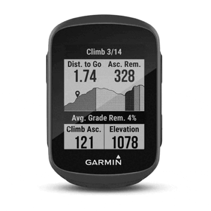
Garmin Edge 130 plus
- Extremely lightweight and compact GPS bike computer for road and MTB with easy to read 1.8" display even in direct sunlight or low light
- Performance evaluation and easy training plan synchronization
- Navigation with turn-by-turn instructions and route display
- ClimbPro for optimal planning of upcoming climbs
- MTB Dynamics with grit --, flow and jump analysis
- With GPS, GLONASS and Galileo satellites and an altimeter, you'll know how far, fast, hard and high you've ridden on the longest climbs or on your way through the city
- Includes navigation with turn prompts and even shows you how to get back to start; download courses from the Course Creator feature in Garmin Connect™ online community, and race in real time against Strava Live Segments
- Compatible with Varia™ cycling awareness accessories, including rear-view radar and smart bike lights
- Connected features include smart notifications, weather and more; LiveTrack and Assistance features make it easy to share your location
- Battery life: up to 12 hours

-3%
Garmin GPSMAP 66i
- Large 3” sunlight-readable color display for easy viewing
- Trigger an interactive SOS to the GEOS 24/7 search and rescue monitoring center; two-way messaging via the 100% global Iridium satellite network (satellite subscription required)
- Preloaded Garmin TOPO mapping with direct-to-device BirdsEye Satellite Imagery downloads (no annual subscription); includes multiple Global Navigation Satellite Systems support and navigation sensors
- Cellular connectivity lets you access Active Weather forecasts and Geocaching Live
- Compatible with the Garmin Explore™ website and app to help you manage waypoints, routes, activities and collections, use tracks and review trip data from the field
- Internal, rechargeable lithium battery provides up to 35 hours of battery life in 10-minute tracking mode and 1-minute tracking mode (display off); 200 hours in Expedition mode with 30-minute tracking
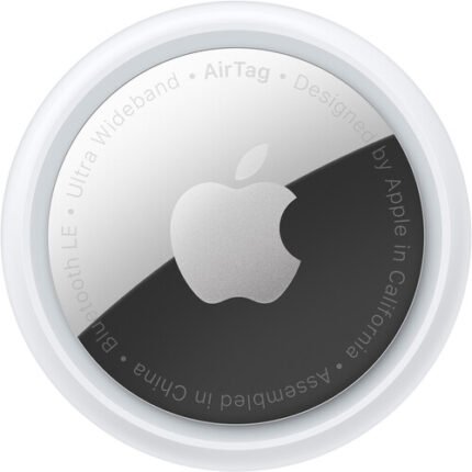
Apple AirTag (Single)
- Track & Locate with Find My Network
- Precision Finding via Ultra Wideband
- Use with Keys, Wallet, Bags & More
- See Direction, Distance & Map Location
- Works with Apple's Find My App
- Built-In Speaker Plays Location Sound
- Find Items by Asking Siri
- Entire Process is Anonymous & Encrypted
- Over a Year of Battery Life
- Standard Battery is Replaceable