



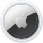
Apple AirTag (4-Pack)
KSh 12,299.00
- Track & Locate with Find My Network
- Precision Finding via Ultra Wideband
- Use with Keys, Wallet, Bags & More
- See Direction, Distance & Map Location
- Works with Apple’s Find My App
- Built-In Speaker Plays Location Sound
- Find Items by Asking Siri
- Entire Process is Anonymous & Encrypted
- Over a Year of Battery Life
- Standard Battery is Replaceable
Kindly Note: Prices and Stock Status are Subject to Change without Prior Notice
Apple AirTag (4-Pack) in Kenya
Apple AirTag (4-Pack) Price in Kenya is Ksh.12,299. Never worry about losing devices and other belongings again with the Apple AirTag. This sleek tracking disc can be slipped into a wallet or tablet case, or you can use an optional accessory to key it with your keys or attach it to a purse, bag, or backpack. Wherever the AirTag goes, you can use Apple’s Find My app to find it. When it’s nearby, use the Find My app to locate it, have your AirTag play a sound through its built-in speaker, or you can simply say “Hey Siri, find my key.”. Notifications can also be viewed on an Apple Watch, and if you own an iPhone 11 or 12, you can take advantage of Precision Finding. If your item is truly lost, you can even employ the wider Find My network of Apple devices to locate it. This item included 4 AirTags that can be used in multiple items or shared with your family.GET Apple AirTag (4-Pack) at the best price in Nairobi,Kenya from Starmac Technologies.
Precision Finding
Find My Network
Lost Mode
Privacy Features
Unwanted Tracking
One-Tap Setup
Long & Replaceable Battery
Water & Dust Resistant
Related products


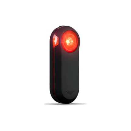
Garmin Varia RTL515 Rearview Radar with Tail Light
- Rearview radar with tail light provides awareness of vehicles approaching from behind up to 153 yards away
- Daylight visibility up to 1 mile alerts motorists to bike's presence as soon as possible
- Peloton mode provides a low-intensity light flash that's ideal for cycling in groups
- Compact vertical design mounts easily to most road-use bicycles
- Pairs seamlessly with Garmin Edge bike computer or compatible smartphone as well as select Garmin wearables or the Garmin radar display unit
- When radar device is used with compatible smartphone, the Varia app provides graphics-plus tone and vibration alerts-to indicate approaching cars
- When used with a compatible smartphone, radar integrates with third-party apps such as Ride with GPS to overlay your maps with rearview radar alerts
- Battery life: up to 16 hours in day flash mode, up to 6 hours in solid mode
- Includes mounting kit, power cable, and documentation


Garmin Zumo Xt-Mt
- Robust and weatherproof all-terrain motorcycle navigation system (IPX7 standard) with ultra-bright 5.5-inch HD touch display
- Use in portrait and landscape format as well as comfortably usable with gloves
- Street navigation maps for Europe including updates
- Pre-installed topographic maps for the site navigation in Europe
- BirdsEye satellite images via download included
- Garmin Adventurous Routing, round trip, route planning and TracBack function
- Live weather, live traffic and more via Garmin Drive app
- TripAdvisor, Foursquare, iOverlander and Garmin Motorrad POIs
- Bluetooth hands-free function, music control and integrated MP3 player
- Built-in track recorder with compass and elevation profile
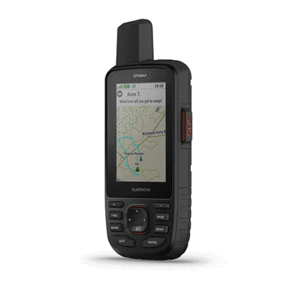
Garmin Gpsmap 67i
MULTI-BAND GNSS SUPPORT
Access multiple global navigation satellite systems (GPS, Galileo and QZSS). Get access to multiple frequencies sent by navigation satellites for improved position accuracy in areas where GNSS signals are reflected, weak or typically don’t penetrate.
ABC SENSORS
Navigate every trail with ABC sensors, including an altimeter for elevation data, barometer to monitor weather and 3-axis electronic compass.
SATELLITE IMAGERY
Download high-resolution photorealistic maps directly to your device via Wi-Fi® technology. Easily find trails, pick stand locations and parking, create waypoints and more.
PRELOADED TOPOACTIVE EUROPE MAPS
Preloaded TopoActive Europe maps show you summits, parks, coastlines, rivers, lakes and geographical points.
PREMIUM MAP FEATURES
With an Outdoor Maps+ subscription, you get public land information, landowner names, state plat maps, BLM boundaries and more. (USA Only)
BATTERY LIFE
Turn on expedition mode, and get up to 425 hours of battery life while using inReach technology. In the default tracking mode, you get up to 165 hours of battery life, and your device will save your location every 10 minutes.
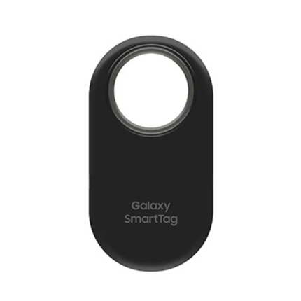
Samsung Galaxy SmartTag 2
- REDESIGNED TO DO MORE: The redesigned Galaxy SmartTag2 is made so you can keep calm and keep track*; Its design makes it easy for you to tag and carry your belongings
- EASY TO USE: It’s IP67-rated water- and dust-resistant**, activates your compatible IoT devices****** and stays powered for up to 500 days*** or even up to 40% more on Non-Power Saving Mode*******
- RELAX, YOU’VE GOT IT TAGGED: Simply register a new Galaxy SmartTag2 and get started right away with SmartThings Find; With its intuitive tracking experience, you now have a way to keep track of things you love right in the palm of your hand*
- SEARCH NEAR WHEN IT’S NOT FAR: Lose something? Switch on Search Nearby**** and get guided instructions to your item’s location via Compass View*****; If you still don’t see it, just ring your Galaxy SmartTag2 to have it send out an audible signal
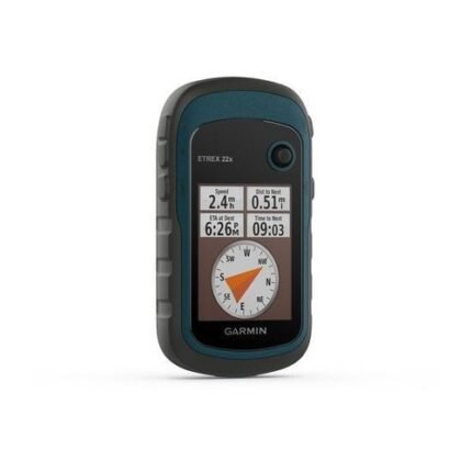
Garmin ETREX 22X
- 2.2” sunlight-readable color display with 240 x 320 display pixels for improved readability
- Preloaded with TopoActive maps with routable roads and trails for cycling and hiking
- Support for GPS and GLONASS satellite systems allows for tracking in more challenging environments than GPS alone
- 8 GB of internal memory for map downloads plus a microSD™ card slot
- eTrex 32x adds a 3-axis compass and barometric altimeter
- Battery life: up to 25 hours in GPS mode with 2 AA batteries